
Subscribe
Winter’s Encore: Snow Returns for the Start of March
Battle Creek prepares for a slushy transition as a rain-snow mix arrives this Tuesday.
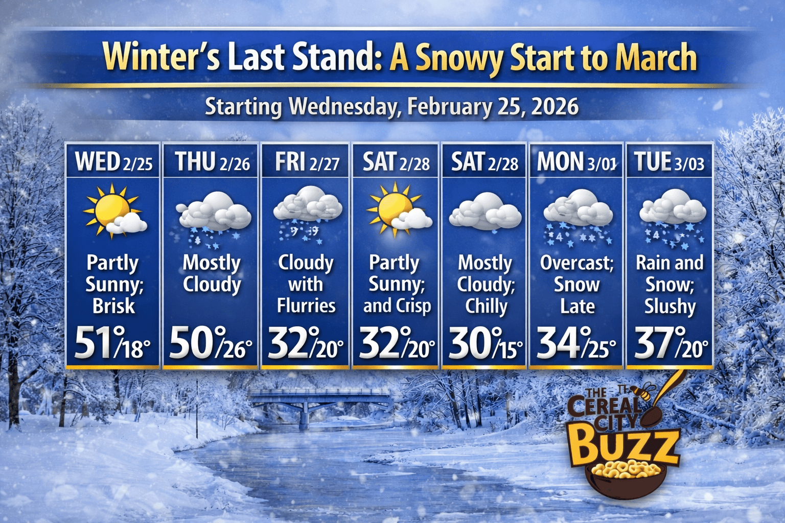
Winter’s Last Stand: A Snowy Start to March
Battle Creek faces a return to sub-freezing temperatures and consistent snow chances as February fades away.
After a brief flirtation with milder air, the Cereal City is settling back into a true Michigan winter pattern.
As we transition from February into the first few days of March, the thermometer is heading south once again.
Expect a week defined by heavy cloud cover, biting winds, and several opportunities to keep those snow shovels busy.
The most significant shift occurs early next week.
While we’ll see some "peeks" of sun over the weekend, a moisture-rich system moves in by Tuesday, March 3rd.
We are tracking a rain-snow mix that will likely transition to steady snow showers by the evening.
With a high of 37°F and a low of 22°F, the slushy conditions could make for a messy evening commute.
Looking ahead, the humidity remains high at 82%, and light southeasterly winds will keep the air feeling damp and cold.
It’s a stark reminder that while the calendar says March is arriving, winter isn't ready to surrender its grip on Calhoun County just yet.
Bundle up, stay safe on the roads, and enjoy the beauty of what might be one of our last major snowfalls of the season.
Cereal City Weather Q&A
Q: Is "Meteorological Spring" actually starting on March 1st with these temperatures? A: Technically, yes! While the calendar flips to meteorological spring this Sunday, Mother Nature hasn't received the memo. With highs staying stuck in the low 30s and overnight lows reaching as far down as 15°F, it’s going to feel much more like mid-winter in Battle Creek than a spring awakening.
Q: Should we be concerned about ice during the Tuesday transition? A: With a high of 37°F dropping to 22°F on Tuesday, the primary concern is "flash freezing" after sunset. Any rain or slush that accumulates during the day will likely harden into ice overnight. If you have evening plans on March 3rd, keep a close eye on the pavement as temperatures crash.
Q: Is this the last of the snow for the season? A: It’s tempting to hope so, but history tells us otherwise! In Michigan, we often see a "tug-of-war" between seasons throughout March. While the intensity of the cold is beginning to fade, the high humidity (82%) and moisture-rich systems moving in suggest we’ll be dealing with at least a few more rounds of the white stuff before the tulips start popping up. |
Stay up to date with our local news!
Get articles like this delivered to your inbox.
THIS PUBLICATION SPONSORED BY