
Subscribe
The Big Chill Returns: Snow and Single Digits Ahead
After last week’s thaw, Battle Creek plunges back into a deep freeze with snow chances nearly every day.
 |
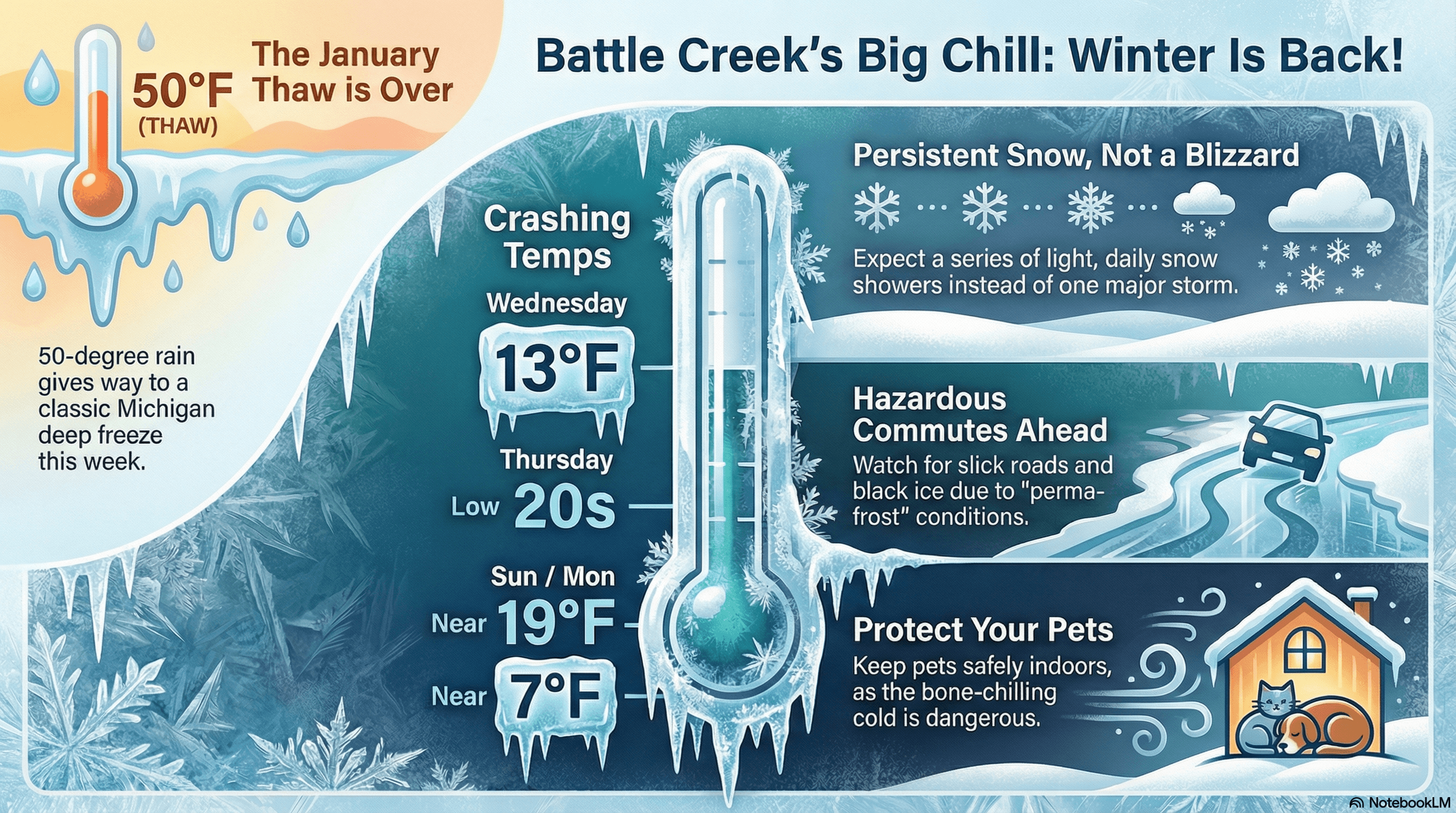
The "January Thaw" has officially left the building.
Battle Creek is trading in the 50-degree rain for a classic Michigan deep freeze.
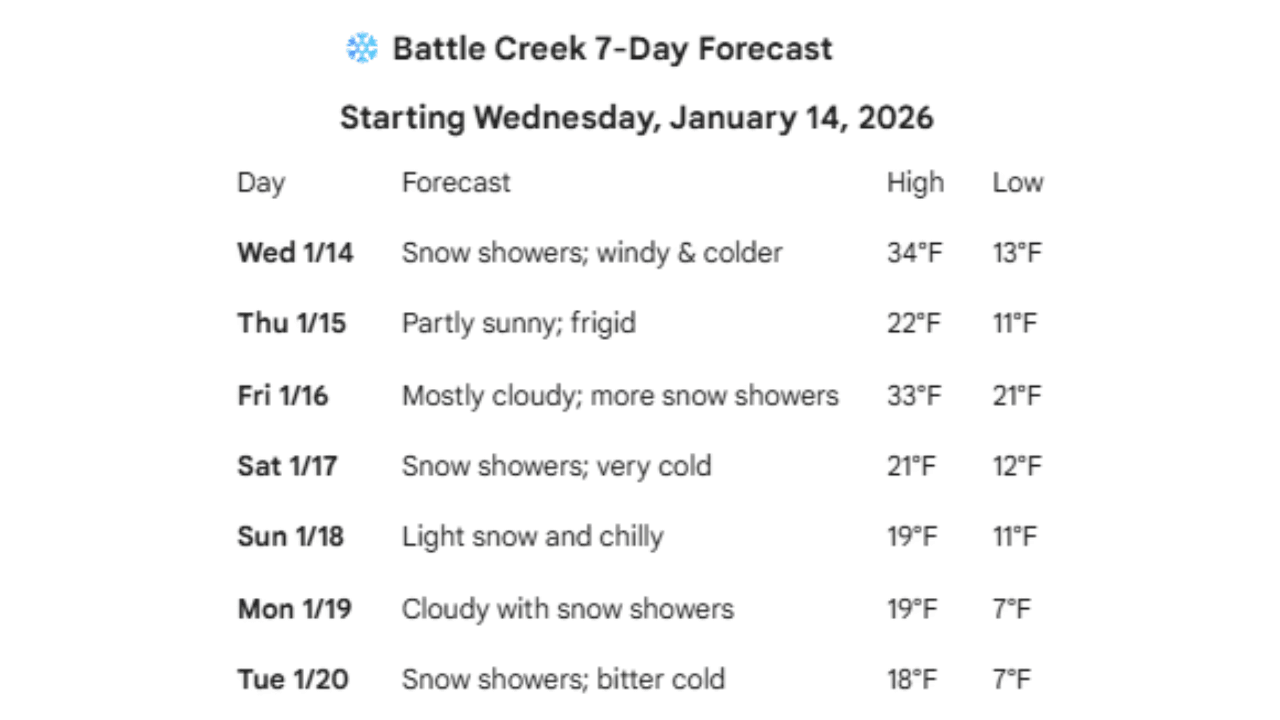
Starting Wednesday, January 14th, the jet stream shifts, pulling arctic air back into the Cereal City and setting the stage for a week defined by sub-freezing highs and persistent snow.
Wednesday serves as the transition day, with temperatures crashing from earlier mild levels down to a low of 13°F. From there, the cold truly takes hold. Highs on
Thursday will struggle to even reach the low 20s, and by the weekend, we won't even see 20°F on the thermometer.
Sunday and Monday are looking particularly brutal, with daytime highs near 19°F and overnight lows plunging toward a bone-chilling 7°F. Precipitation-wise, keep your shovel by the door.
While we aren't tracking a single massive blizzard, a series of disturbances will bring light to moderate snow showers almost daily.
These consistent flurries, combined with the extreme cold, mean roads will stay slick and "perma-frost" will be the theme of the week.
Bundle up, watch for black ice on your morning commute, and make sure your pets are safely indoors, real winter is back! |
Stay up to date with our local news!
Get articles like this delivered to your inbox.
THIS PUBLICATION SPONSORED BY