
Subscribe
Cooler, Unsettled Pattern Settles Into Battle Creek for Mid-June
Daily Shower Chances and Mild Temperatures Replace Last Week’s Summer Heat Across Southwest Michigan
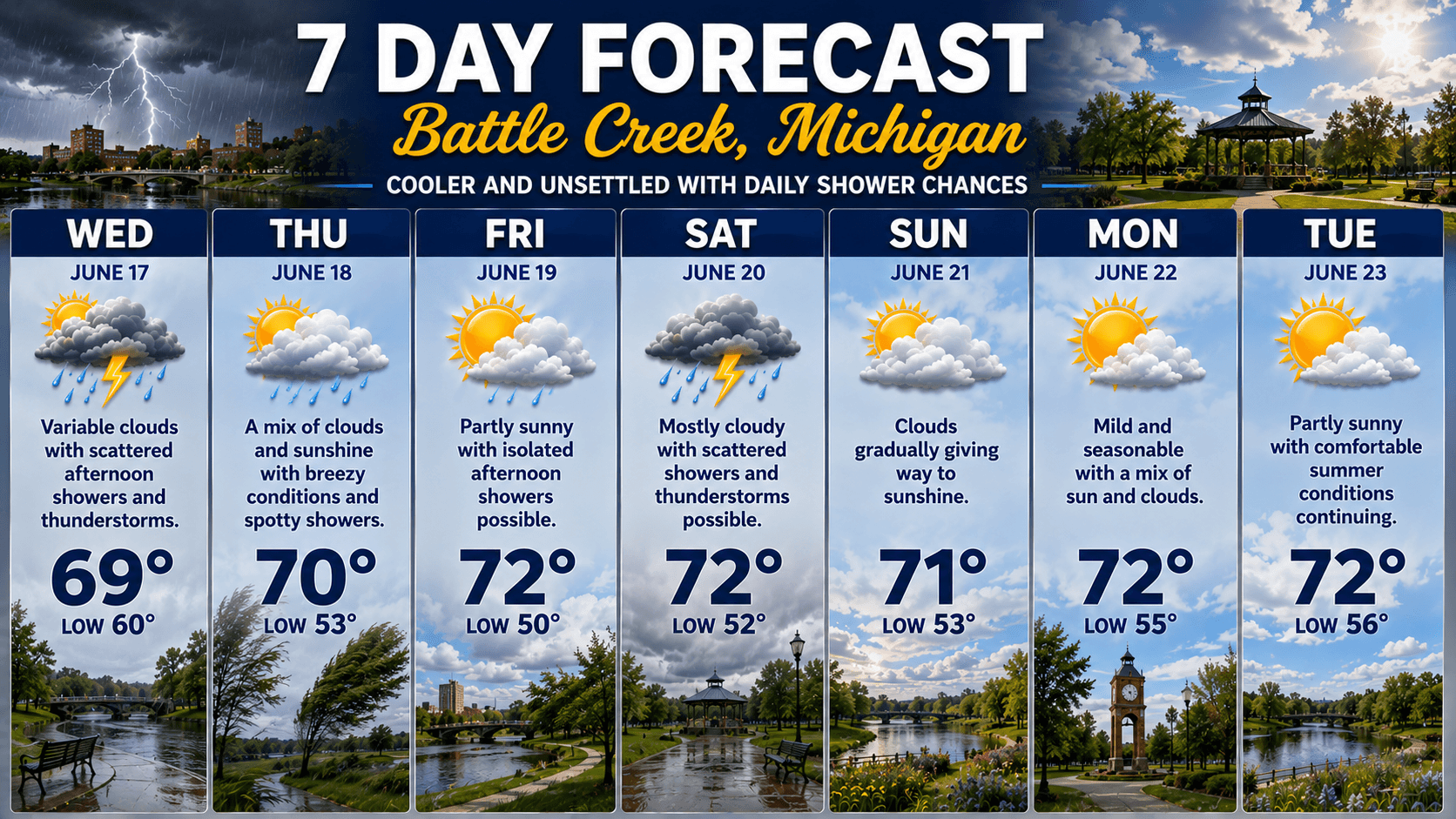
After several days of summer-like heat, Battle Creek is shifting into a much cooler and more unsettled weather pattern as mid-June settles across Southwest Michigan.
The week begins with temperatures staying well below recent highs, with daytime readings hovering in the upper 60s to low 70s.
While the cooler air may be a welcome break for some, it also brings a more active pattern with scattered showers and thunderstorms possible almost every day through the weekend.
Wednesday looks to be one of the wetter days of the stretch, with afternoon thunderstorms possible as unstable air moves into the region.
Thursday and Friday remain similar, with periods of clouds, breezy conditions, and spotty showers mixing in with occasional sunshine.
By the weekend, Battle Creek will continue to see mild temperatures near 72 degrees, but rain chances remain in the forecast, especially on Saturday when another round of scattered thunderstorms could develop.
Sunday looks to bring some improvement, with clouds gradually giving way to sunshine and a drier finish to the weekend.
Looking ahead to early next week, temperatures should remain comfortable and seasonable with a mix of sun and clouds and fewer rain chances.
Overall, it’s a much quieter and cooler stretch of weather compared to the heatwave earlier in June, but residents should keep umbrellas handy as passing showers remain a part of the forecast for much of the week.
|
Stay up to date with our local news!
Get articles like this delivered to your inbox.
THIS PUBLICATION SPONSORED BY