
Subscribe
Winter’s Long Shadow: Snow and Sub-Zero Nights Continue
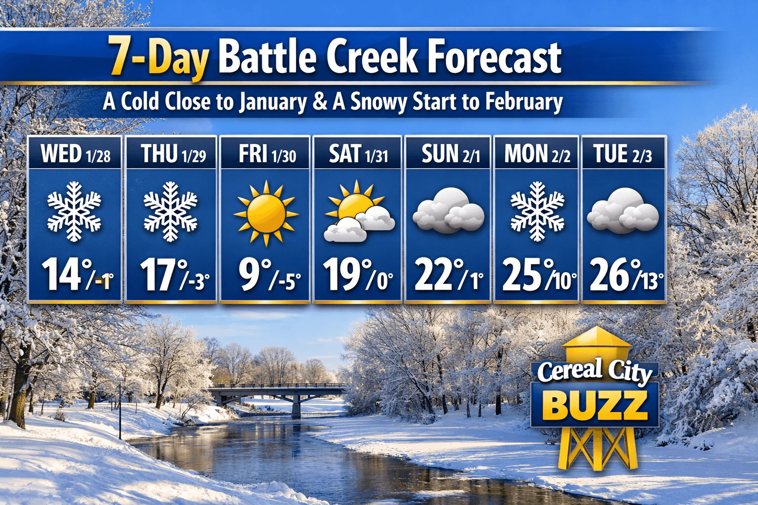
Battle Creek stays in the deep freeze this week with overnight lows hitting -5°F and daily snow chances.
The "Polar Plunge" might be slowly losing its peak intensity, but don’t pack away the heavy layers just yet.
Battle Creek is entering a stretch where the days are short, the air is crisp, and the thermometer refuses to climb out of the basement. As we close out January and flip the calendar to February, the theme for the Cereal City remains "survival mode."
The week starts with a series of persistent snow showers on Wednesday and Thursday.
While we aren't expecting a major accumulation, the sub-freezing temperatures mean every flake will stick, keeping the roads slick for your morning commute.
The most striking part of the forecast arrives Friday: while the sun will finally make a rare January appearance, it brings no warmth.
Friday’s high is a meager 9°F, with the overnight low plunging to a bone-chilling -5°F.
The weekend offers a slight reprieve from the wind, with mostly sunny skies on Saturday and a "warm-up" to 22°F by Sunday.
However, by the time Monday morning rolls around, the snow returns to welcome the new month.
Expect a steady overcast and light flurries through Tuesday.
Keep those ice scrapers handy and check on your neighbors.
Winter is firmly in control of the Cereal City. |
Stay up to date with our local news!
Get articles like this delivered to your inbox.
THIS PUBLICATION SPONSORED BY